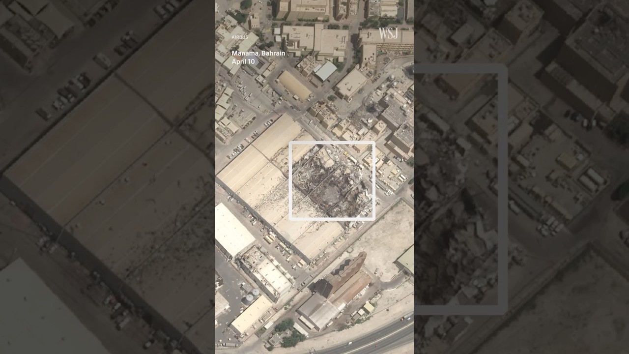
Satellite imagery has unveiled the full scope of damage sustained by Naval Support Activity Bahrain following recent attacks attributed to Iran. High-resolution images captured after the strikes show significant destruction across key areas of the base, including damaged infrastructure and compromised operational zones. These visuals offer the first comprehensive view of the impact, previously difficult to assess due to limited on-the-ground access and restricted reporting. Investigative journalists utilized this remote sensing data to map the precise locations of hits and evaluate the structural integrity of critical facilities.
The findings underscore the strategic challenges now facing the U.S. Navy in maintaining operations at the site. Damage to communications systems, storage units, and support buildings has disrupted routine logistics and heightened concerns about long-term readiness. The use of satellite evidence highlights how modern surveillance tools can deliver crucial insights during military incidents, especially in contested regions like the Persian Gulf. This transparency helps inform public understanding and policy discussions around regional security and defense preparedness.